Every area in the Netherlands is divided into soil quality zones. Those zones are conveniently classified by city/town or area in a so-called “soil quality map. See below, for example, the soil quality map of Amsterdam.
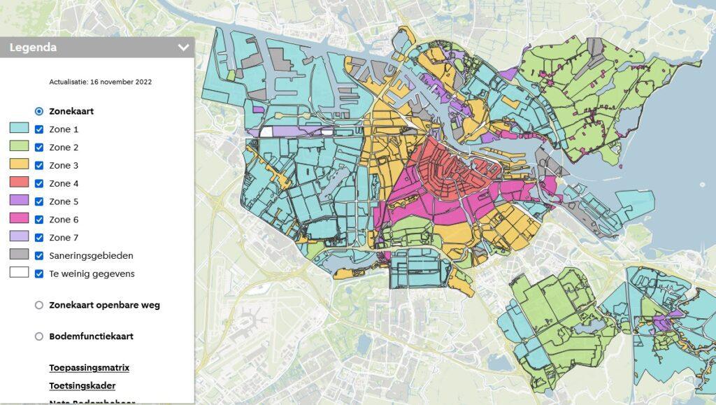
Each zone has a certain average soil quality. Therefore, on the soil quality map you can clearly see the average soil quality of that particular zone. To classify an area into soil quality zones, some criteria that determine the soil quality in a
area and clearly different from other areas or neighborhoods in the city. For Amsterdam, these criteria are:
– Soil composition (including whether or not it was raised);
– Retrieval history;
– Use of soil (residential, industrial, rural).
In this case of Amsterdam, the darker the color, the more polluted. Dark red here is the inner city of Amsterdam which is the most polluted in all of Amsterdam.
On the website bodemloket.nl you should be able to find and download the soil quality map of every area in the Netherlands. However, in practice, this website does not appear to contain all the complete data.
Advice from environmental consulting and research firm
Are you sitting with an issue on a piece of property. For example, do you want to be sure if the soil is clean and have a historical or exploratory soil survey done? Or do you need advice on reading a soil report? Then ask an environmental research firm for a remote opinion or to conduct an exploratory soil survey on site. As a nationwide real estate agency, we have several good environmental maintenance agencies sitting throughout the country that we work with. If you would like to get in touch with one of these consulting companies in your area, please fill out this form and we’ll put you in touch with them (free service from us).